Hardergrat Trail: An Honest Guide Before You Attempt It
The Hardergrat is one of Switzerland's most spectacular — and most dangerous — ridge hikes. A local guide's honest guide: difficulty, dangers, route, timing, what to carry, guided options and better alternatives.
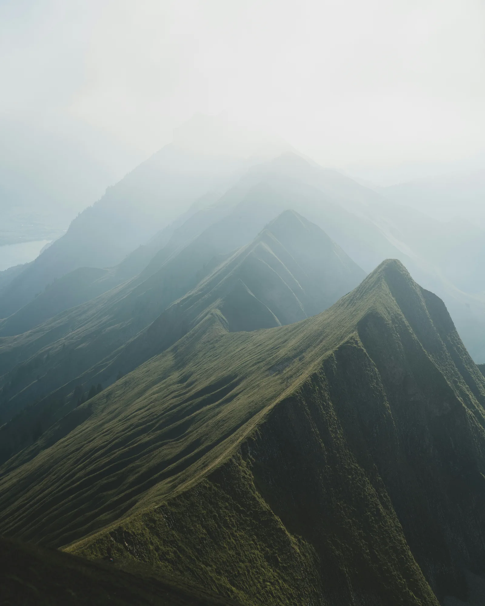
If you've been researching hikes around Interlaken, you've almost certainly come across the Hardergrat. It's on every "best hikes in Switzerland" list and all over Instagram, and it's one of the most searched trails in the country.
So let me start with the most important sentence in this whole post:
A fall on this ridge can be fatal.
That's not meant to put you off. It's meant to make sure you go with real information, not Instagram-filtered expectations. I've lived in the Jungfrau Region since 2016 and guided hikes here since 2017, and this is my honest guide to the Hardergrat.
What is the Hardergrat?
The Hardergrat is a long, narrow ridge high above Lake Brienz, running from the Harder Kulm above Interlaken east towards the Brienzer Rothorn. On a clear day, the views are extraordinary: the turquoise lake far below on one side, and the Eiger, Mönch and Jungfrau on the other. It's rightly called one of the most spectacular ridge walks in the Alps.
It's also genuinely, seriously dangerous in places. This is not a hike for beginners, people without alpine experience, or anyone who underestimates mountain conditions.
How hard is it?
The Swiss rate mountain hikes from T1 (easy walking path) to T6 (difficult alpine terrain). Most popular hikes around Interlaken are T1–T2. Here's what the higher grades mean:
- T3: you need sure feet, good fitness and experience on steep mountain paths.
- T4: you need alpine experience, excellent fitness and confidence on exposed terrain with steep drops.
- T5: close to the upper limit of hiking, just before it becomes real mountaineering.
The Hardergrat is mostly considered T4, with harder, very exposed sections — especially around the Tannhorn, where the ridge is narrow with sheer drops on both sides. It isn't one continuously waymarked hiking route, so you need to know the way.
The numbers:
- Climb: about 3,000 m if you start in Interlaken (less if you take the funicular up to Harder Kulm)
- Time: 8–12 hours, depending on fitness and conditions
- Distance: around 25–30 km, depending on where you start and finish
Is it dangerous?
Yes. Fatal accidents have happened here, and experience doesn't remove the risk. The main dangers:
- Exposure: parts of the ridge are very narrow, with drops of hundreds of metres on both sides.
- Weather: storms can arrive fast, and there's nowhere to shelter on the ridge.
- Heat: there's almost no shade and no water once you're up on the ridge.
- Overconfidence: many people attempt it after seeing photos online, without understanding what T4 terrain really means.
Please don't attempt the Hardergrat if:
- you're not comfortable with heights and exposed terrain
- the weather is uncertain — check the MeteoSwiss forecast, not just your phone's weather app
- you don't have proper hiking boots with ankle support
- you haven't done T3 hikes before
- you're going alone without telling anyone your plan
When to go
- Season: June to October, when conditions allow
- Best months: July and August for stable weather; September for quieter trails and beautiful autumn light
- Start time: an early start is essential for this long traverse. Plan your departure around the route length, conditions and last train down with a qualified mountain guide. The ridge gets very hot by midday, and afternoon thunderstorms are common in summer.
Avoid days with any risk of afternoon storms, early-season days when there can still be snow and ice on the ridge, and late starts.
Practical information
- Start: Interlaken, or Harder Kulm if you take the funicular up
- Finish: Brienzer Rothorn, for the classic eastbound traverse
- Getting down: the Brienz Rothorn Bahn runs down to Brienz in summer. Check the timetable for the last train before you set off — and have a plan B in case you miss it, because walking down adds hours.
- Water: carry at least 2.5–3 litres. There's almost no water on the ridge.
- Food: take everything you need. There are no huts or restaurants along the way.
- Navigation: download the route on the Swisstopo app before you go — don't rely on phone signal.
- Emergency: save 1414 (Rega mountain rescue) in your phone before you set off.
What to wear and carry
- Proper mountain boots with ankle support — not trail runners
- Trekking poles, especially for the descents
- Sun protection: hat, sunscreen and sunglasses
- A rain layer, whatever the forecast
- An emergency bivvy or space blanket
- At least 2.5 litres of water, plus purification tablets
- Food for 10–12 hours
- A fully charged phone with offline maps
- A first aid kit
Can I do the Hardergrat with a guide?
Yes. I can arrange a guided Hardergrat traverse with one of my certified mountain guides. The guide will talk with you beforehand about your experience and fitness, choose the right day and start time, and decide on the day whether the conditions are safe — because on this ridge, that decision matters more than anything.
A guide doesn't make the Hardergrat easy, though. You still need excellent fitness, a head for heights and experience on steep, exposed mountain terrain.
My rule is simple: if you're not sure you're ready for the Hardergrat, you're probably not ready for the Hardergrat. If you're unsure, send me a message about your experience — I'll tell you honestly, and if it's not the right fit yet, I'll suggest something that is.
→ Ask about a guided Hardergrat traverse
Not ready for the Hardergrat? Try these instead
You can have spectacular days in the Jungfrau Region without the risk:
- North Face Trail, Mürren — dramatic views of the Eiger North Face, beginner friendly, and one of the most beautiful trails in the region. It's my signature guided hike.
- Männlichen to Kleine Scheidegg Panorama Trail — easy, mostly level and stunning, with the Eiger, Mönch and Jungfrau in front of you.
- Bryndli — Mürren's local peak, with a short, steep, exposed final section and a 360° view: a small taste of ridge walking with much less risk.
- Schilthorn Summit Hike — a big, challenging day to 2,970 m, with the summit restaurant waiting at the top.
- Allmendhubel Flower Trail — gentle, beautiful and perfect for an easier day.
Frequently asked questions
How long does the Hardergrat take?
Usually 8–12 hours, depending on your fitness, where you start and the conditions.
How difficult is the Hardergrat?
It's mostly considered T4 on the Swiss hiking scale, with harder, very exposed sections, especially around the Tannhorn. It's for experienced, very fit mountain hikers only.
Can I do the Hardergrat with a guide?
Yes — I can arrange a guided traverse with a certified mountain guide. Send me a message with your dates and experience, and we'll check together whether it's right for you.
Is there water on the Hardergrat?
Almost none once you're on the ridge. Carry at least 2.5–3 litres.
When is the best time to hike the Hardergrat?
From July to September, on a settled, dry day with no risk of afternoon storms. Plan an early start that allows enough time for the full traverse and descent.
Can beginners do the Hardergrat?
No. Beginners should choose easier trails like the North Face Trail or the Männlichen–Kleine Scheidegg Panorama Trail.
Final word
The Hardergrat deserves its reputation as one of Switzerland's most spectacular ridge walks. If you have the fitness, the experience and the right conditions, it's an extraordinary day. Go prepared, go early, check the weather obsessively, and don't let Instagram convince you it's easier than it is.
If you'd like to do the Hardergrat with a certified mountain guide, send me a message with your dates and experience. And if you'd like to explore the Jungfrau Region at any level, join me on a guided hike — I promise the views are just as good. For more ideas, see Best Things to Do in Interlaken.
Explore with a local
Looking for another way to explore? This is an alternative experience, not a guided version of the route in this story.
Summer · Guided hike
Schilthorn Summit Hike
A longer mountain day for hikers looking for a challenge.
Stay safe out there,
Laura